
Disclosure: This post may contain affiliate links, meaning I get a commission if you decide to make a purchase through my links, at no extra cost for you!
If you’re looking for something to do this weekend and would like to explore our beautiful surroundings, these amazing Peak District walks near Manchester will be perfect.
As a Manchester local myself, I spend a lot of time hiking in the Peaks and there are so many beautiful places you can discover too!
In just over an hour, you can be at the famous Roaches and in just 30 minutes you can be at a WWII crash site in the heart of the Peaks.
Keep reading to discover these amazing Peak District walks that are super close to Manchester.
1. Kinder Scout via Jacob’s Ladder

| Quick Info about the walk |
|---|
| 📍Distance from Manchester: 1 hr 16min / 30.3 miles |
| 🥾 Walking Time: 4h 10m |
| 🗺️ Length: 12.7 km |
| 🚗 Carpark: Yes (free) |
| 🏁 Starting Point – 📌 Walk trail map |
Kinder Scout is one of the best Peak District walks near Manchester and is a popular route among hikers.
Kinder Scout is the highest point in the Peak District and provides stunning views of the surrounding moorland.
Of all the Peak District hikes near Manchester this is one of the most challenging.
At just 12.7km, this loop trail starts at Barber Booth carpark which is near Edale train station. Don’t underestimate the length of this walk, which on average takes around 4 hours.
Many hikers find it takes a little longer than this because you will want to stop for photos.
The start of the trail is quite a tough scramble for around 2 miles and if it’s rained in the last couple of days, you may experience some boggy marsh underfoot for another mile or so.
Be sure to come prepared with all the right footwear. The challenging start makes the expansive views all the more rewarding.
🚗 HOW TO GET THERE: You can either drive or take the train to Edale. From the centre of Manchester, it takes around an hour and just under 30 miles to drive.
You can also take the train from Piccadilly to Edale which takes around 40 minutes. Edale’s car park is right across from the train station.
2. Castleton, Mam Tor and the Great Ridge

| Quick Info about the walk |
|---|
| 📍Distance from Manchester: 1hr 8min / 28.5 miles |
| 🥾 Walking Time: 4h32m |
| 🗺️ Length: 12.9km |
| 🚗 Carpark: Yes |
| 🏁 Starting Point – 📌 Walk trail map |
This 12.9km circular trail starts and ends in Castleton at the Mam Nick car park, about an hour’s drive outside of Manchester.
It is generally considered to be a moderately challenging route that takes around four and a half hours to complete.
Mam Tor is a 517 metre hill and a popular area for backpacking and camping.
With a hike involving Mam Tor it’s always best to start off early so that you can beat the crowds and have nature almost entirely to yourself. This route from Castleton is known as one of the country’s best ridge walks.
You’ll be in for some incredible vistas on this walk, with views of Edale, the Hope Valley and the side of Kinder Scout.
With quite a few inclines this route does get the heart pumping and you should be careful with the loose rocks underfoot.
As you head along Great Ridge the route tends to become quieter, and you’ll be treated to views of rolling fields filled with sheep and cows.
The most difficult part of the climb is Cave Dale as it’s stony and you need to watch your step.
HOW TO GET THERE: You can drive taking the A642 out of Manchester towards Castleton. This journey takes just over an hour.
3. B29 Overexposed Crash Site

| Quick Info about the walk |
|---|
| 📍Distance from Manchester: 30 min / 14.3 miles |
| 🥾 Walking Time: 4h21m |
| 🗺️ Length: 13.4 km |
| 🚗 Carpark: Yes (free) |
| 🏁 Starting Point – 📌 Walk trail map |
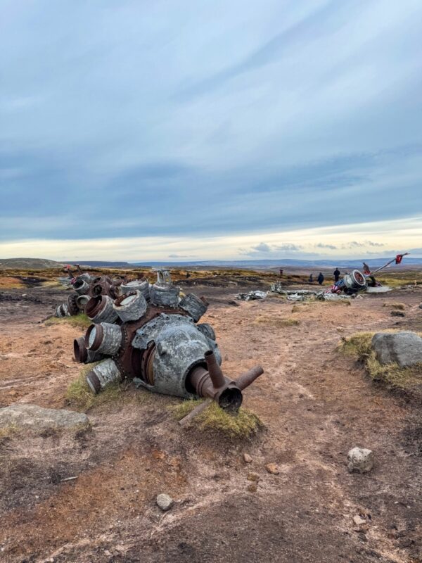
Of the Peak District walks near Manchester those interested in history and aviation will love this route.
Located just a couple of miles from Glossop this walk allows you to see the B-29 Overexposed crash site.
The remains of an American World War II Boeing Superfortress bomber plane can be found here.
The aircraft crashed on the 3rd November 1948 whilst traveling from RAF Scampton to Burtonwood. American pilots are able to name their aircrafts and this aircraft was called ‘Overexposed’.
This route starts outside The Wheatsheaf Inn and is a circular route that takes around 4 hours to complete.
This route is notoriously boggy, though some of the route is paved you will need to bring tall hiking boots.
HOW TO GET THERE: Driving to The Wheatsheaf Inn is just 30 minutes’ from Manchester. This is also one of those Peak District walks that can be reached by train.
The train from Manchester Piccadilly to Glossop takes less than 40 minutes and usually requires one or no changes. You can park in the pub car park and head there for a drink upon your return.
4. The Roaches

| Quick Info about the walk |
|---|
| 📍Distance from Manchester: 1h 18 min / 36.3 miles |
| 🥾 Walking Time: 1h 11m |
| 🗺️ Length: 3.4 km |
| 🚗 Carpark: Yes (free) |
| 🏁 Starting Point – 📌 Walk trail map |
The Roaches escarpment is one of the most famous parts of the peak district.
If you are looking for walks in the Peak District near Manchester, then this is a great choice.
Located in the Staffordshire Peak District just above the town of Leek, the Roaches are characterised by rocky outcrops and stone ridge.
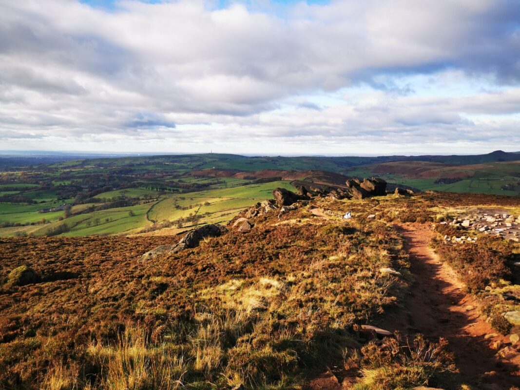
This walk starts near Upper Hulme along a narrow lane that runs parallel to the Roaches, where you can park on the roadside.
It’s best to head there early as it can become very busy. Once you’ve parked, you’ll find a footpath that links Hen Cloud on your right and the Roaches on your left.
It’s quite a quick and easy walk that should only take a bit over an hour to complete.
HOW TO GET THERE: From Manchester, it is best to drive to Upper Hulme and park in the small lane that runs next to the Roaches.
5. Pots and Pans
| Quick Info about the walk |
|---|
| 📍Distance from Manchester: 32min / 7.6 miles |
| 🥾 Walking Time: 1h27m |
| 🗺️ Length: 3.9km |
| 🚗 Carpark: Yes |
| 🏁 Starting Point – 📌 Walk trail map |
Of the Peak District walks from Manchester this one is really convenient.
Located in Oldham just 30 minutes from the centre of Manchester it’s perfect for a quick escape to nature.
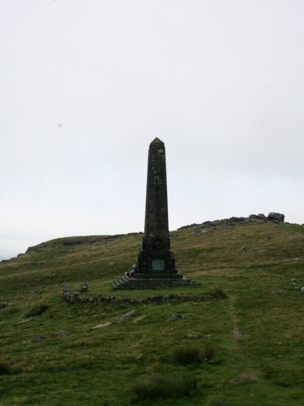
This route starts at the Cross Keys Inn before heading along the Oldham Way and takes around one and a half hours to complete.
This is considered a moderate route owing to the steep hill at the start of the walk.
Once you reach the monument you will be treated to expansive views of the Dark Peak.
HOW TO GET THERE: Driving from Manchester via the A62 takes just under 35 minutes. Alternatively, you can take the train to Greenfield and start from there.
6. Alport Castles
| Quick Info about the walk |
|---|
| 📍Distance from Manchester: 51 min / 27.8 miles |
| 🥾 Walking Time: 4h25m |
| 🗺️ Length: 13.8km |
| 🚗 Carpark: Yes (free) |
| 🏁 Starting Point – 📌 Walk trail map |
Another of the best Peak District walks near Manchester is the Alport Castles and Fairholmes Circular. This route provides picturesque views of rolling hills and jaggy ridges.
The route starts at Fairholmes car park on the Ladybower Reservoir.
This is considered to be one of the best hill walks near Manchester.
Because of all the undulating hills this route is considered to be moderately challenging. The trail is open year-round and is enjoyed by hikers and mountain bikers alike.
With one big climb and a second shorter one you will surely be rewarded with fabulous views along the top of the trail.
This is a long hike that usually takes around four and a half hours to complete.
HOW TO GET THERE: Whilst it is easier to drive to the Fairholmes car park at Ladybower Reservoir (around 50 minutes from Manchester) it is possible to travel by train. You can take a northern line train to Bamford which takes 1h 30m and then a bus to the reservoir.
7. Ladybower Reservoir

| Quick Info about the walk |
|---|
| 📍Distance from Manchester: 52min / 26.8 miles |
| 🥾 Walking Time: 2h10m |
| 🗺️ Length: 6.9km |
| 🚗 Carpark: Yes (free) |
| 🏁 Starting Point – 📌 Walk trail map |
This Ladybower Reservoir walk offers views of the reservoir and the surrounding greenery. This walk starts near Ashopton.
You’ll start the walk by heading towards the Ladybower Viaduct before heading through Ashopton and a farm. In a matter of no time, you will be treated to views of the reservoir.
The route then passes through Whinstone Lee Tor along the length of Derwent Edge.
This walk is just over 6 km and takes around 2 hours to complete. You’ll find this to be a popular walk among walkers and birdwatchers but there are plenty of chances for solitude.
HOW TO GET THERE: It’s easiest to drive to Ladybower Reservoir and park at the Heatherdene car park and then walk towards Ashopton.
8. Bamford Edge and Stanage Edge

| Quick Info about the walk |
|---|
| 📍Distance from Manchester: 1hr 1min / 30.4 miles |
| 🥾 Walking Time: 2hr 34 |
| 🗺️ Length: 8.7km |
| 🚗 Carpark: Yes |
| 🏁 Starting Point – 📌 Walk trail map |
The Bamford Edge and Stanage Edge circular is another of the best Peak District walks near Manchester.
This walk starts at the Dennis Knoll car park close to Hope. You should aim to arrive early as the car park is fairly small.
This moderately challenging loop walk is just under 9 km and takes around 2 ½ hours.
🐕 It should be noted that dogs are not allowed on this trail.
This route really packs in all the countryside scenery.
You get to walk along two rugged escarpments with incredible views of the moorland and valleys. You will first need to head along the Long Causeway where you will begin your climb of Bamford Edge.
It’s here you are treated to views of Ladybower Reservoir. You will soon approach Rivelin Tunnel Sighting Towers.
After 0.9km you’ll start to gently descend the hill and head towards Jarvis Clough. After another uphill climb you’ll reach Stanage Edge and its incredible rocky views.
HOW TO GET THERE: Again, driving is by far the easiest way to get to Dennis Knoll car park where this walk starts.
From Manchester head along the A57, down Snake Road, and past the Ladybower Reservoir to reach the car park.
You can get a train from Piccadilly to Hathersage but then you will need to either walk for 45 minutes to the start of the hike or catch a ride.
9. The Trinnacle & Dovestone Reservoir

| Quick Info about the walk |
|---|
| 📍Distance from Manchester: 42 min / 14.1 miles |
| 🥾 Walking Time: 4h 20m |
| 🗺️ Length: 9.2 km |
| 🚗 Carpark: Yes (pay and display) |
| 🏁 Starting Point – 📌 Walk trail map |
This is one of the best walks in the Peak District near Manchester. Views of the Dovestone Reservoir, rocky outcrops and moorland characterise this walk, making for a fantastic four hours.
You can park and start this walk at the southern end of the reservoir at Dovestone car park. On this 10.4km route around the reservoir you can head clockwise or anti-clockwise.
Much of the route hugs the shoreline along pathways. You will reach the main attraction of this trail, ‘The Trinnacle’ just over halfway through your hike.
The Trinnacle is a fork-shaped pillar made from gritstone. You can actually climb up and stand on top of this rock formation, making for some great pictures.
HOW TO GET THERE: From Manchester head along the A635 for 14 miles to reach the Dovestone Reservoir.
You can also take the TransPennine Express to Greenfield station, then bus 350 to Clarence Hotel (around 10 min walk to the reservoir from there) and from there it’s around a 10-minute walk to the start of this walk.
10. Laddow Rocks
| Quick Info about the walk |
|---|
| 📍Distance from Manchester: 40 mins / 17 miles |
| 🥾 Walking Time: 4h 45m |
| 🗺️ Length: 14km |
| 🚗 Carpark: Yes |
| 🏁 Starting Point |
This 14 km circular route is near Glossop in Derbyshire. It takes under five hours to complete and provides an exhilarating walking workout.
Starting at the Crowden car park this walk first heads up Laddow Rocks. The first part of the hike requires some scrambling which won’t be easy for young children or some dogs.
As you ascend beautiful views will unfold before your eyes. You will then travel along the edge until you reach Black Hill. Then you will begin your loop back around past an old quarry and back into Crowden.
HOW TO GET THERE: There is no train station close to this walk so it is best to drive from Manchester. Head to the Crowden car park on Woodhead Road, SK13 1HZ where you can park for free.
11. Wildboar Clough
| Quick Info about the walk |
|---|
| 📍Distance from Manchester: 43 min / 16.8 miles |
| 🥾 Walking Time: 3 hours |
| 🗺️ Length: 9.5km |
| 🚗 Carpark: Yes (fee) |
| 🏁 Starting Point – 📌 Walk trail map |
Another of the best Peak District walks near Manchester is Wildboar Clough and the Lawrence Waterfall Circular. If you are searching for an invigorating hike this trail near Glossop is perfect.
This trail starts just 650 metres from the Woodhead Pass St James’ Church. This is one of those off the beaten track hikes.
The walk up Wildboar Clough is difficult and requires some scrambling but provides you with gorgeous views.
To reach the waterfall, continue along the trail and you’ll need to do a fair bit of scrambling where there isn’t a clearly defined path. This is one of the reasons this walk is considered to be hard.
HOW TO GET THERE: The best way to get to Woodhead Pass St James’ Church is to drive via the M67, A57 and A628.
You may also be interested in:
